Building the data foundation for ecosystem intelligence.
We build data infrastructure for ecological intelligence — combining AI, remote sensing, and field science to create live models of ecosystem condition. We deliver the intelligence organisations need to understand ecosystem condition, forecast ecological change, and restore ecosystems.
What we do
Our services →Restoration & Biodiversity Monitoring
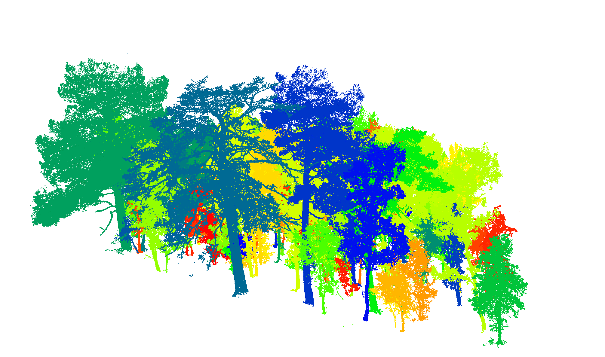
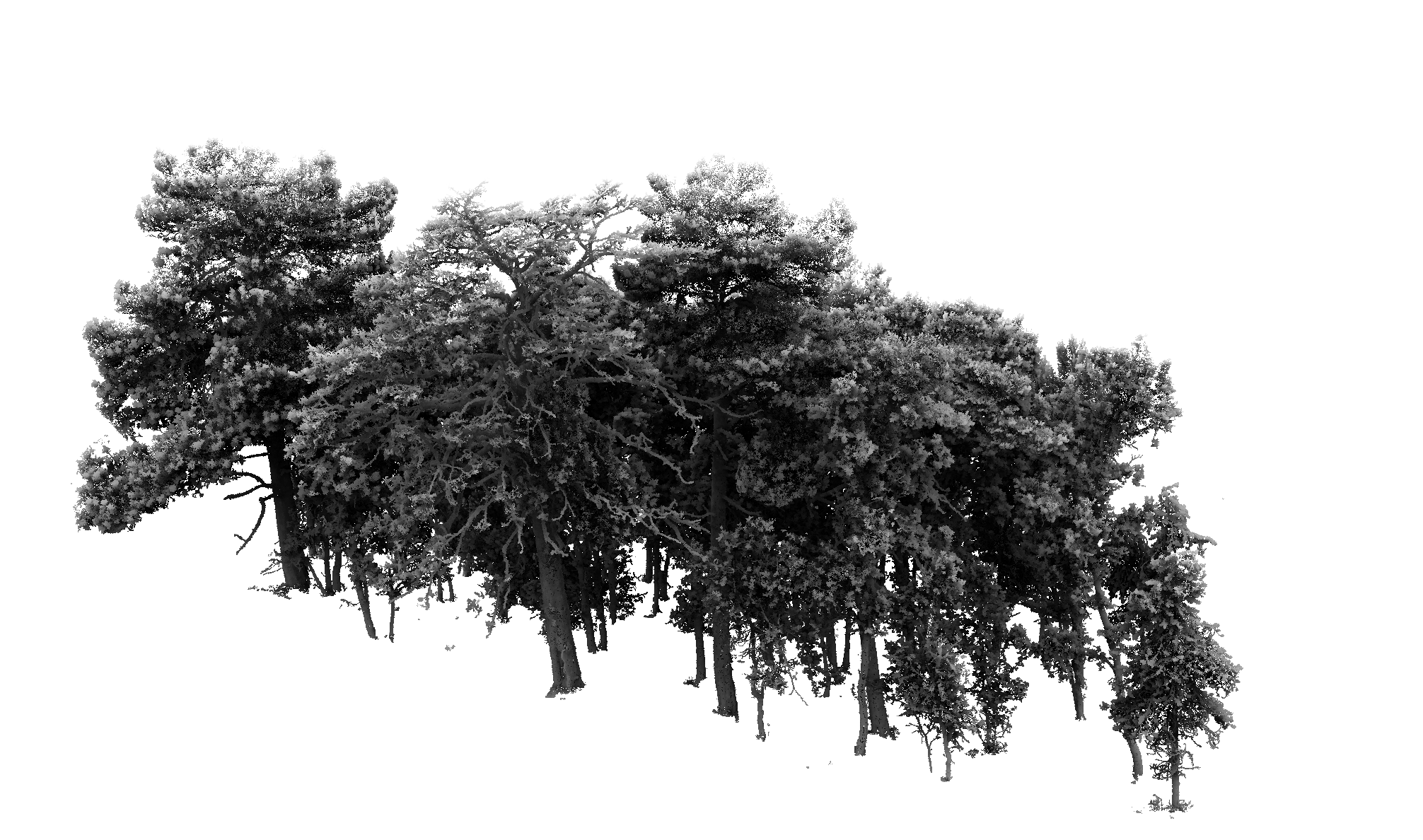
From drone transects and acoustic surveys to repeat satellite sampling — we build verifiable recovery trajectories. Habitat baselines, species detection, and long-term change records that meet BNG, TNFD, and nature market audit requirements. Methods: UAV survey, TLS, bioacoustics, satellite time-series.
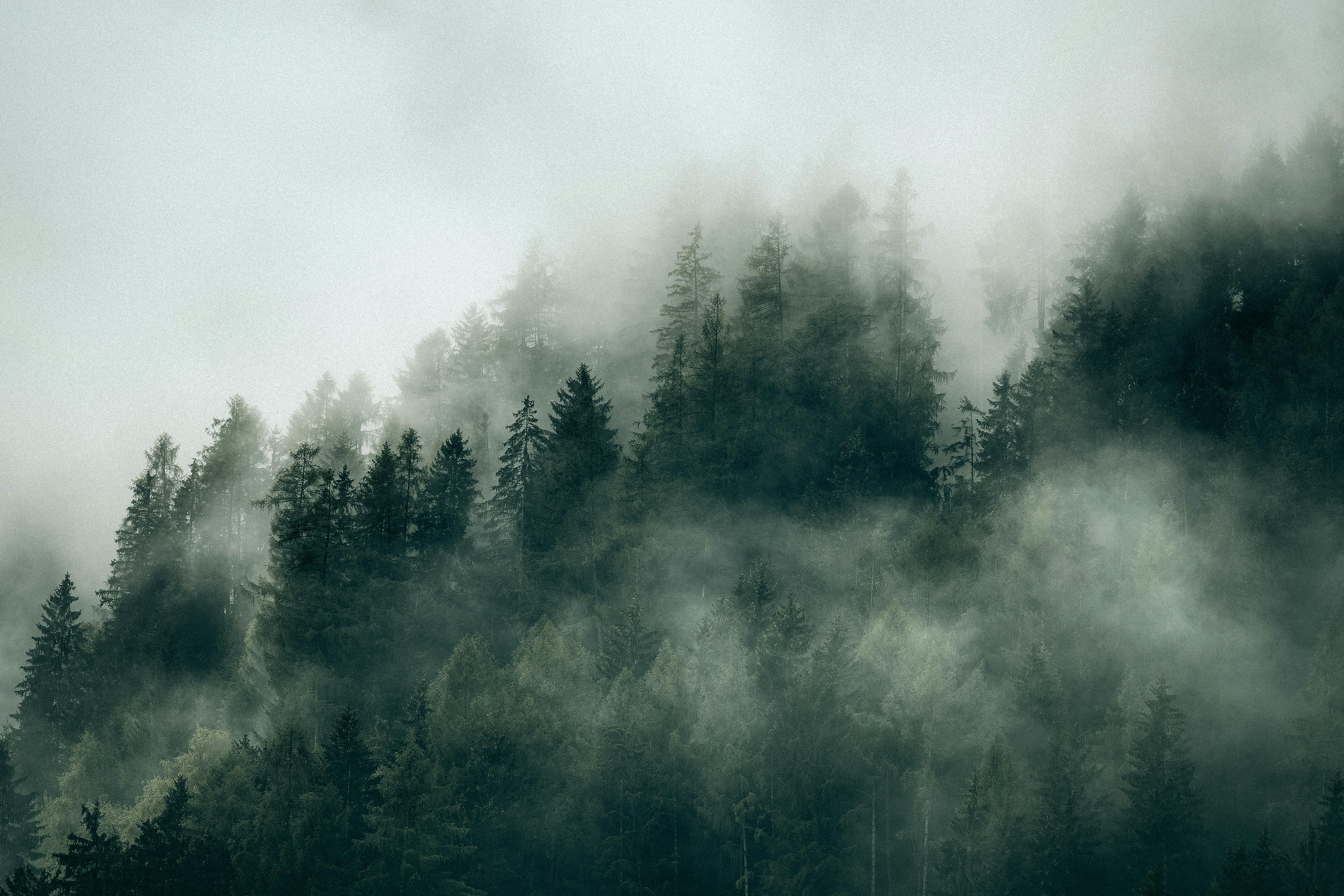
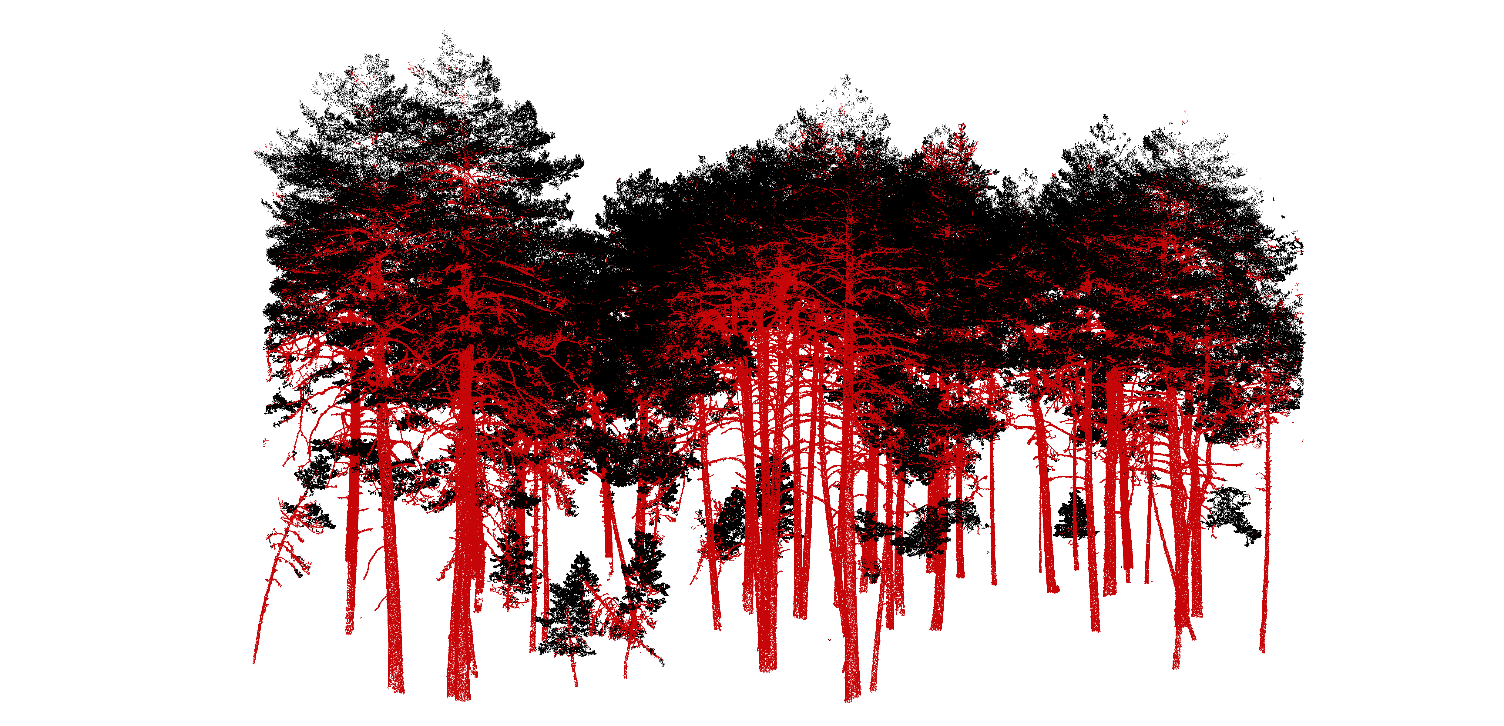
AOI-IOM-01 · South Barrule · Isle of Man
54.09°N · 4.72°W · Upland Heath & Plantation · 483m asl
Biomass
mean · ±6.1
Canopy ht
p95 dominant
Biodiversity
habitat units
Growth
afforestation
Mortality
dieback det.
Restoration & Biodiversity Monitoring
From drone transects and acoustic surveys to repeat satellite sampling — we build verifiable recovery trajectories. Habitat baselines, species detection, and long-term change records that meet BNG, TNFD, and nature market audit requirements. Methods: UAV survey, TLS, bioacoustics, satellite time-series.
Carbon & Nature Markets
MRV-grade measurement from field to satellite. We quantify above-ground biomass and carbon stock using TLS-derived allometrics, LiDAR canopy structure, and satellite embeddings — producing audit-ready outputs aligned to Woodland Carbon Code, BNG statutory metric, CSRD, and TNFD disclosure.
Landscape Intelligence
Digital twin-scale modelling for risk and resilience. Flood exposure, windthrow probability, storm impact corridors, and infrastructure hazard derived from high-resolution terrain, canopy structure, and hydrological models. Designed for government, infrastructure managers, and institutional clients operating at catchment to national scale.
Academic background
 Queen Mary University of London
 University of CambridgeQueen Mary University of LondonUniversity of Cambridge
Recent work
All projects →Restoration · Defra UK
Wet Woodland Distribution in England
Interactive mapping of wet woodland extent, density and restoration potential across England at 10m resolution. Delivered for Defra UK.
Explore →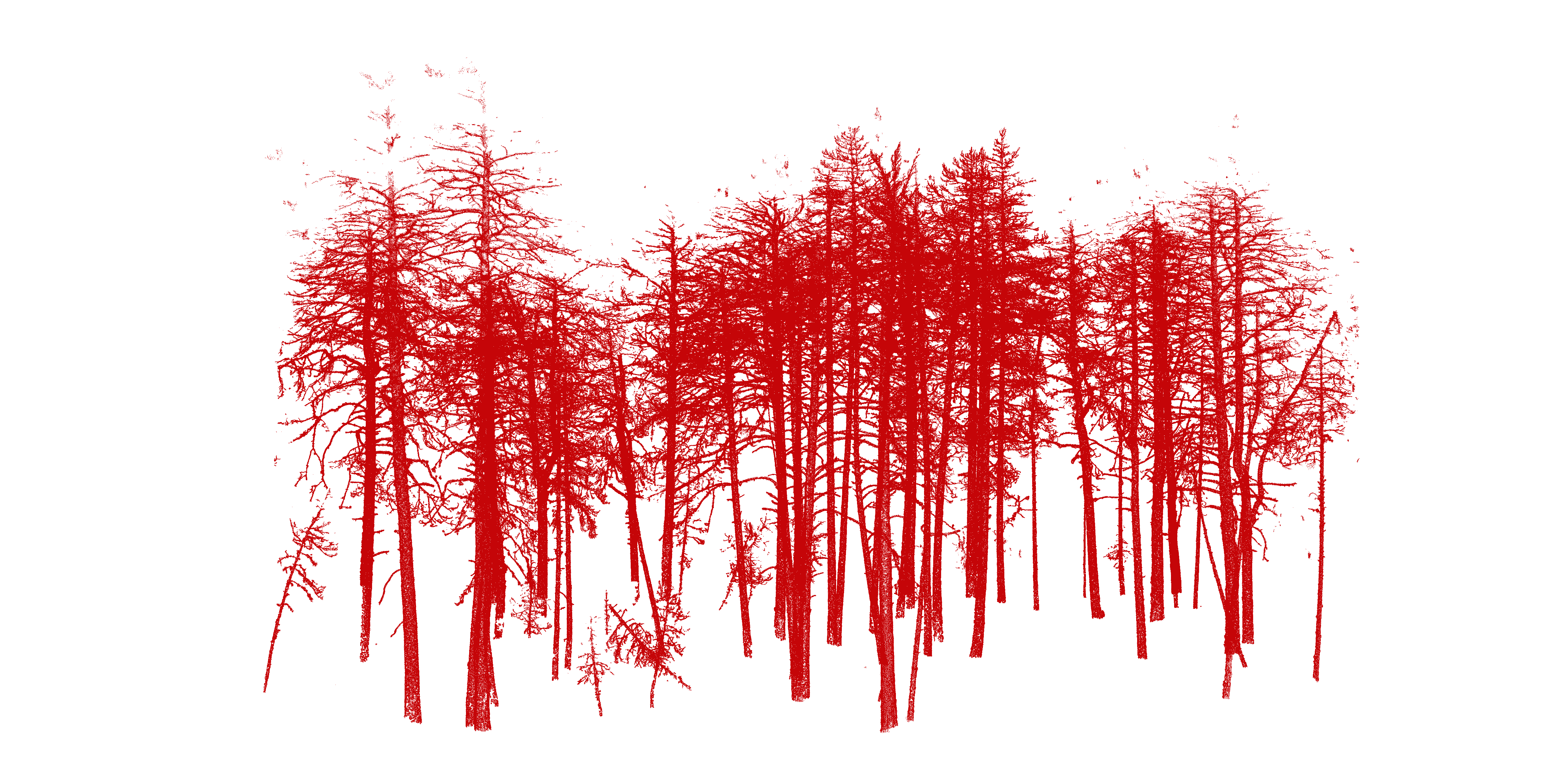
Carbon · LiDAR
Forest Carbon Structure from Point Clouds
Above-ground biomass and canopy structure quantified using deep learning segmentation of airborne LiDAR — delivering MRV-grade carbon stock estimates at individual-tree scale.
Explore →Landscape Intelligence · Satellite
Landscape-Scale Change Monitoring
Time-series satellite analysis to detect, attribute, and quantify land cover change — providing the persistent monitoring layer for long-term nature market and restoration commitments.
Explore →Live proof of concept
The Isle of Man as digital twin.
An integrated ecosystem measurement system where continuous multimodal data — eco-acoustics, spectral biodiversity, 3D forest structure, terrain, and real-time satellite embeddings — feed learning systems that map complex ecosystems at landscape scale.
The model captures ecosystem condition, biodiversity patterns, structural dynamics, and how these evolve across the island. You can interrogate it to understand which habitats are thriving, where critical shifts are occurring, how resilient different areas are to change, and how upstream ecosystems cascade to downstream condition.
As a secondary capability: these same ecosystem insights reveal how natural systems inform infrastructure vulnerability and exposure. This is what integrated ecosystem measurement looks like — not monitoring three separate metrics, but building a learning system that understands how complex natural systems work, change, and interconnect.
Habitat baseline: island-wide classification at 10m
Carbon monitoring: TLS-calibrated woodland carbon stocks
Risk modelling: flood and windthrow exposure, full road network
Trusted by
Outputs aligned to: